Florida weather: Relentless rain and savage storms to tear through state as hurricane season loomsStory by Reanna Smith
Another wave of severe weather tore through Florida on Wednesday amid sea breeze collisions along the I-75 corridor.
The line of strong thunderstorms died down overnight but parts of the Sunshine State could continue to experience daily downpours and scattered storms throughout the week. It comes as we get further into the 2025 hurricane season.
The National Oceanic and Atmospheric Administration (NOAA) has already predicted an above-normal season this year. And Colorado State University also predicted an above-average hurricane season with 17 named storms, nine hurricanes, and four major hurricanes.
But experts warn that the Trump administration's Department of Government Efficiency cuts have created vacancies at the National Weather Service (NWS) offices that will have a negative impact on the accuracy of storm forecasts for local communities this year.
Where in Florida will be hit by more storms?Most of Central and Eastern Florida, including Orlando and the Atlantic Coast, will remain largely hot and dry with only isolated storm chances this week.
However, storms will continue to target the western interior and Gulf Coast areas, particularly along the I-75 corridor, from The Villages through Ocala and down to Tampa.
Orlando could still experience a few isolated thunderstorms in the early to mid-afternoons but areas west of the region, along I-75 and toward the Gulf Coast, including Tampa and St. Petersburg, will experience a greater threat for organized storms.
The storm track has shifted notably, with the majority of afternoon storms now likely to hit the west coast while Orlando and the Atlantic side see fewer impacts.
Severe summer storms die down but unsettled weather continues
While Wednesday's round of severe storms have died down, an unsettled weather pattern will continue to impact Florida.
Heat will continue to be the most dominant weather feature. Inland highs are set to reach between 90 and 94 degrees while afternoon head index values could reach triple digits, sitting between 100 and 104 degrees.
At the same time, rain and thunderstorm chances will remain high for Tampa to Sarasota, Fort Myers and the I-75 corridor through Sunday.
Isolated storms cannot be ruled out around Orlando and along the I-4 corridor, but those areas are likely to stay mostly dry.
"Rain chances continue to favor the west coast, Tampa, Sarasota, Ft. Myers, and I-75 corridor. Yes, obviously a t-storm here or there is possible in the Orlando area. Chances are low compared to the west coast, Ocala, Gainesville, and The Villages," said FOX 35 Storm Team Meteorologist Noah Bergren. "This is valid for Friday, Saturday, and Sunday."
Experts tracking tropical activityExperts are continuing to track any signs of tropical activity as the hurricane season gets underway. Tropical activity currently remains quiet in the Atlantic basin. However, forecasters are predicting continued high activity in the eastern Pacific over the next seven days as hurricane season ramps up.

Tropical analysis meteorologist Aidan Mahoney works at his station at the National Oceanic and Atmospheric Administration's (NOAA) National Hurricane Center in Miami, Florida, on May 30, 2025. The administration of US President Donald Trump has fired hundreds of staff at the National Oceanic and Atmospheric Administration (NOAA) and deleted government websites with data on the weather and climate. (Photo by CHANDAN KHANNA / AFP) (Photo by CHANDAN KHANNA/AFP via Getty Images) © AFP via Getty Images
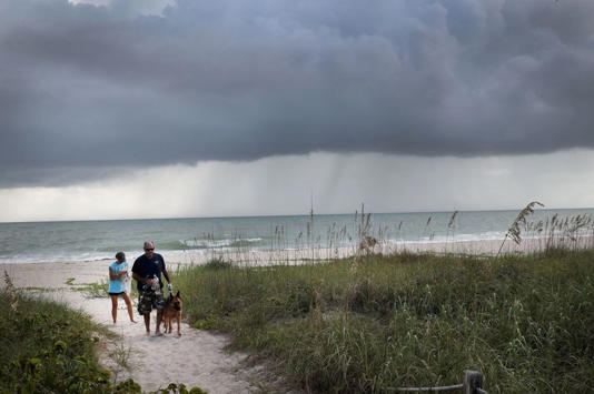
FORT PIERCE, FLORIDA - AUGUST 31: Rain clouds move toward shore as as Hurricane Dorian churns off the coast on August 31, 2019 near Fort Pierce, Florida. Dorian, once expected to make landfall near Fort Pierce as a category 4 storm , is currently expected to turn north and stay off of the Florida coast, lessening the impact on the area. (Photo by Scott Olson/Getty Images) © Getty Images
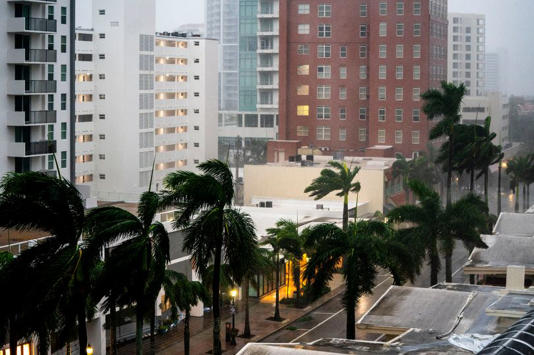
SARASOTA, FLORIDA - OCTOBER 9: Wind and rain batter the area as Hurricane Milton approaches on October 9, 2024 in Sarasota, Florida. Milton, which comes just after the recent catastrophic hurricane Helene, will hit Florida's central Gulf Coast and is expected to make landfall with destructive winds and flooding. (Photo by Sean Rayford/Getty Images) © Getty |


