I see what you're talking about -g-
Coordinates:  48°08'38?N 17°06'35?E? / ?48.14389°N 17.10972°E? / 48.14389; 17.10972 48°08'38?N 17°06'35?E? / ?48.14389°N 17.10972°E? / 48.14389; 17.10972
Bratislava City

Bratislava Montage

Flag

Coat of arms
Nickname: Beauty on the Danube, Little Big City
Country Slovakia Region Bratislava
Districts Bratislava I, II, III, IV, V Rivers Danube, Morava, Little Danube
Elevation 134 m (440 ft) Coordinates  48°08'38?N 17°06'35?E? / ?48.14389°N 17.10972°E? / 48.14389; 17.10972 Highest point Devínska Kobyla - elevation 514 m (1,686 ft) Lowest point Danube River - elevation 126 m (413 ft) 48°08'38?N 17°06'35?E? / ?48.14389°N 17.10972°E? / 48.14389; 17.10972 Highest point Devínska Kobyla - elevation 514 m (1,686 ft) Lowest point Danube River - elevation 126 m (413 ft)
Area 367.584 km2 (142 sq mi) - urban 853.15 km2 (329 sq mi) - metro 2,053 km2 (793 sq mi)
Population 431,061 (2009-12-31) - urban 586,300 - metro 659,578 Density 1,173 / km2 (3,038 / sq mi)
First mentioned 907 Government City council Mayor Milan Ftácnik
Timezone CET ( UTC+1) - summer (DST) CEST ( UTC+2) Postal code 8XX XX Phone prefix 421 2 Car plate BA, BL


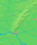
Location in Slovakia


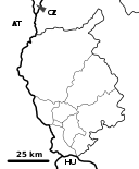
Location in the Bratislava Region
Wikimedia Commons: Bratislava Statistics: MOŠ/MIS Website: bratislava.sk
Bratislava ( ['brac?slava] (  listen); German: Pressburg formerly Preßburg, Hungarian: Pozsony) is the capital of Slovakia listen); German: Pressburg formerly Preßburg, Hungarian: Pozsony) is the capital of Slovakia
The history of the city, long known by the German name Preßburg, has been strongly influenced by people of different nations and religions, namely by Austrians, Czechs, Germans, Hungarians, Slovaks, and Jews. [4] The city was the capital of the Kingdom of Hungary, a part of the larger Habsburg Monarchy territories, [5] from 1536 to 1783 and has been home to many Slovak, Hungarian, and German historical figures. |


