Cliff Mass Weather and Climate Blog
This blog discusses current weather, weather prediction, climate issues, and other topics
Monday, July 30, 2018
Smoke Reaches Western Washington
The smoke is back over western Washington and it is about to get worse, as California wildfire smoke pushes northward over our area.
This morning's sunrise clearly showed a smoke layer, with the reddish glow so familiar from last summer's sunrises and sunsets.
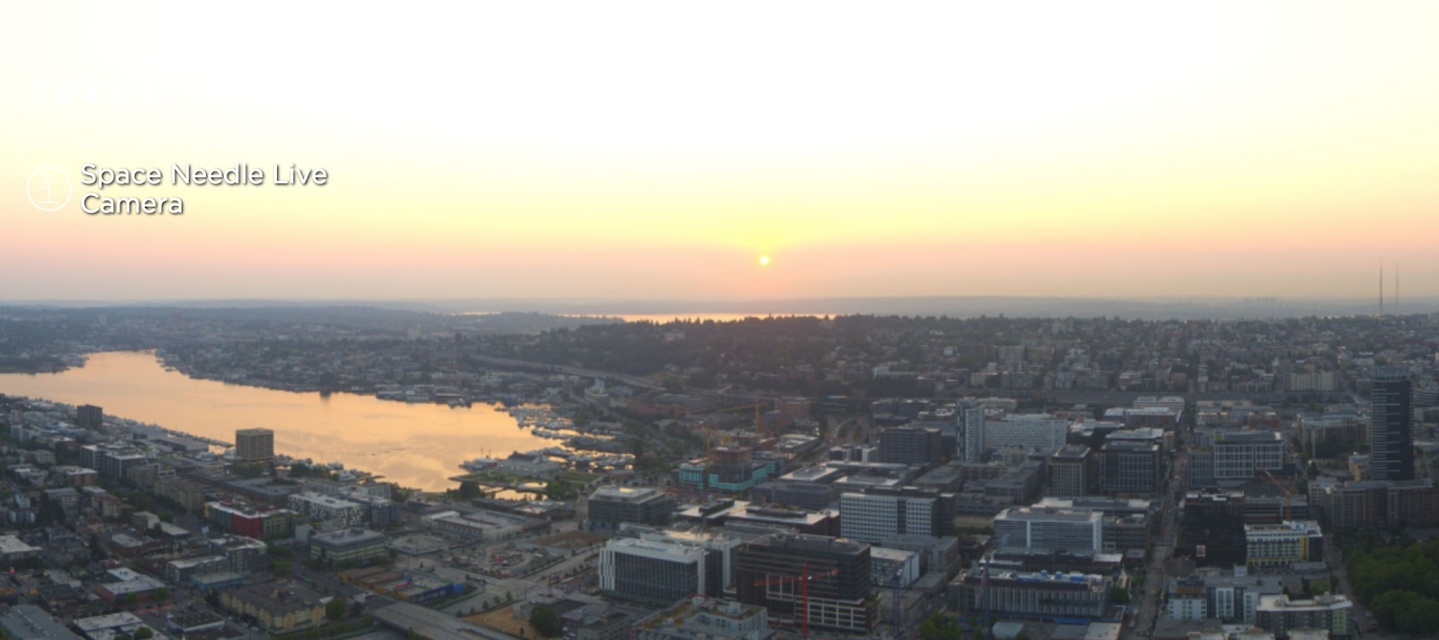
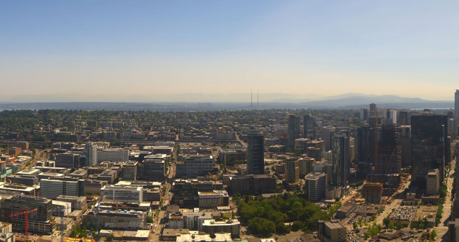
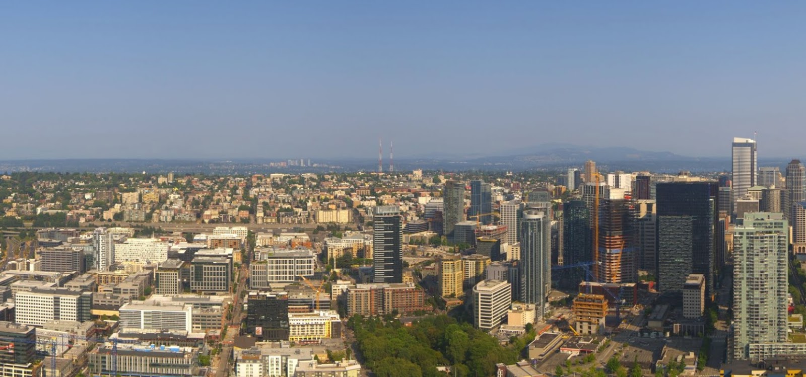
The view of the mountains from Seattle's SpaceNeedle Panocam shows a progressive loss of visibility over the past six days from July 25th to yesterday (all at 5:10 PM).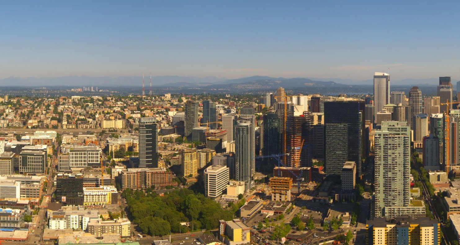
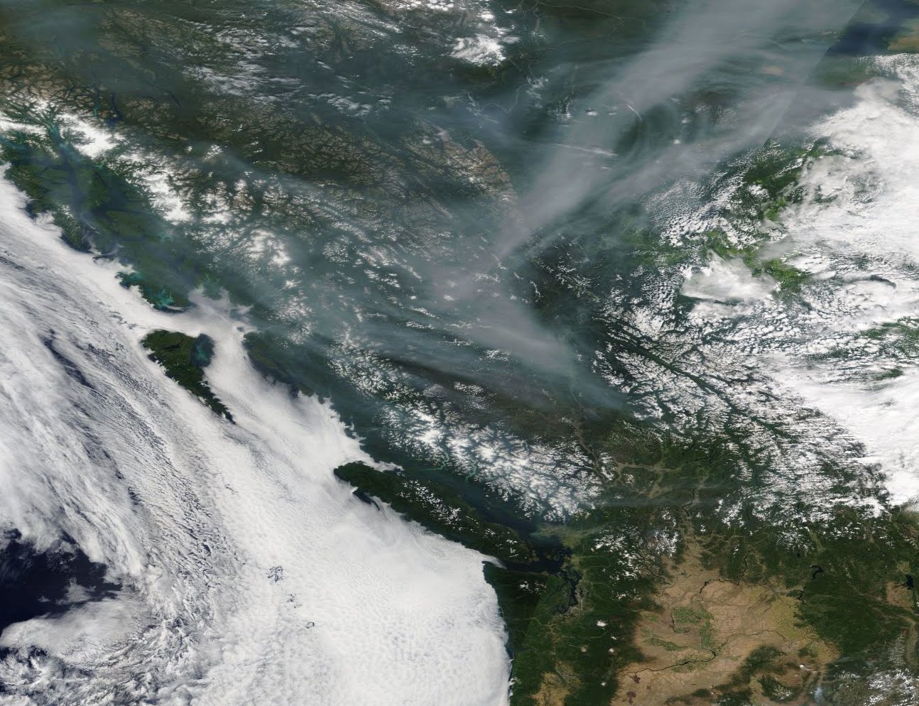
Most of the of smoke has not been local, but rather came from huge fires over Siberia! Here is a satellite image from five days ago, showing the smoke moving southwards towards us. Perhaps Trump can talk to Putin about it.
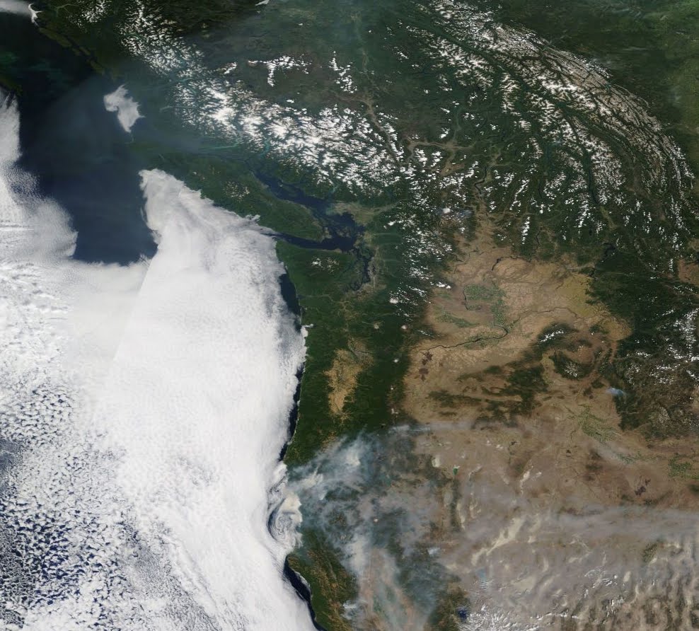
In a similar image yesterday afternoon, you can just make out the Siberian smoke (particularly north of us), if you look carefully. There is also one fire in eastern Washington (Chelan Hills) and a few in southwestern B.C. that are contributing a bit as well. You see all the smoke in California, particularly from the Redding fire? That is coming our way.
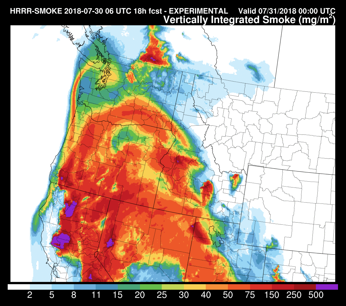
Last nights run of the NOAA HRRR-smoke forecasting system predicted that a significant slug of California smoke will soon reach us. Here are the smoke forecasts for 7 AM and 5 PM today--substantial smoke is moving northward--particularly bad in Oregon, where sunsets will be very red.

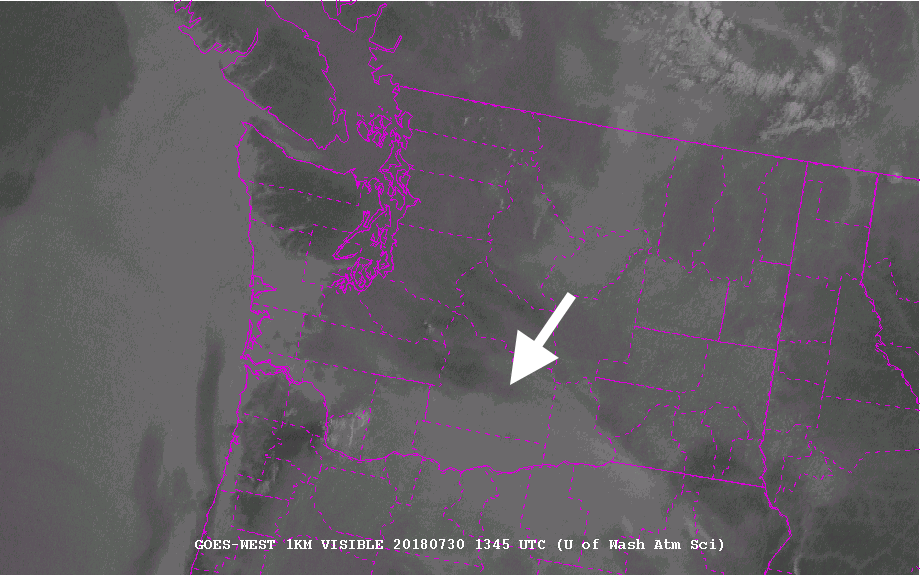
The latest (6:45 AM) visible satellite photo shows the "smoke front" clearly (I put an arrow in to show the leading edge). Something to look forward to. Smoke will be worse over eastern WA than over the West.
Want some good news? The smoke may knock a degree or two off the high temperatures.
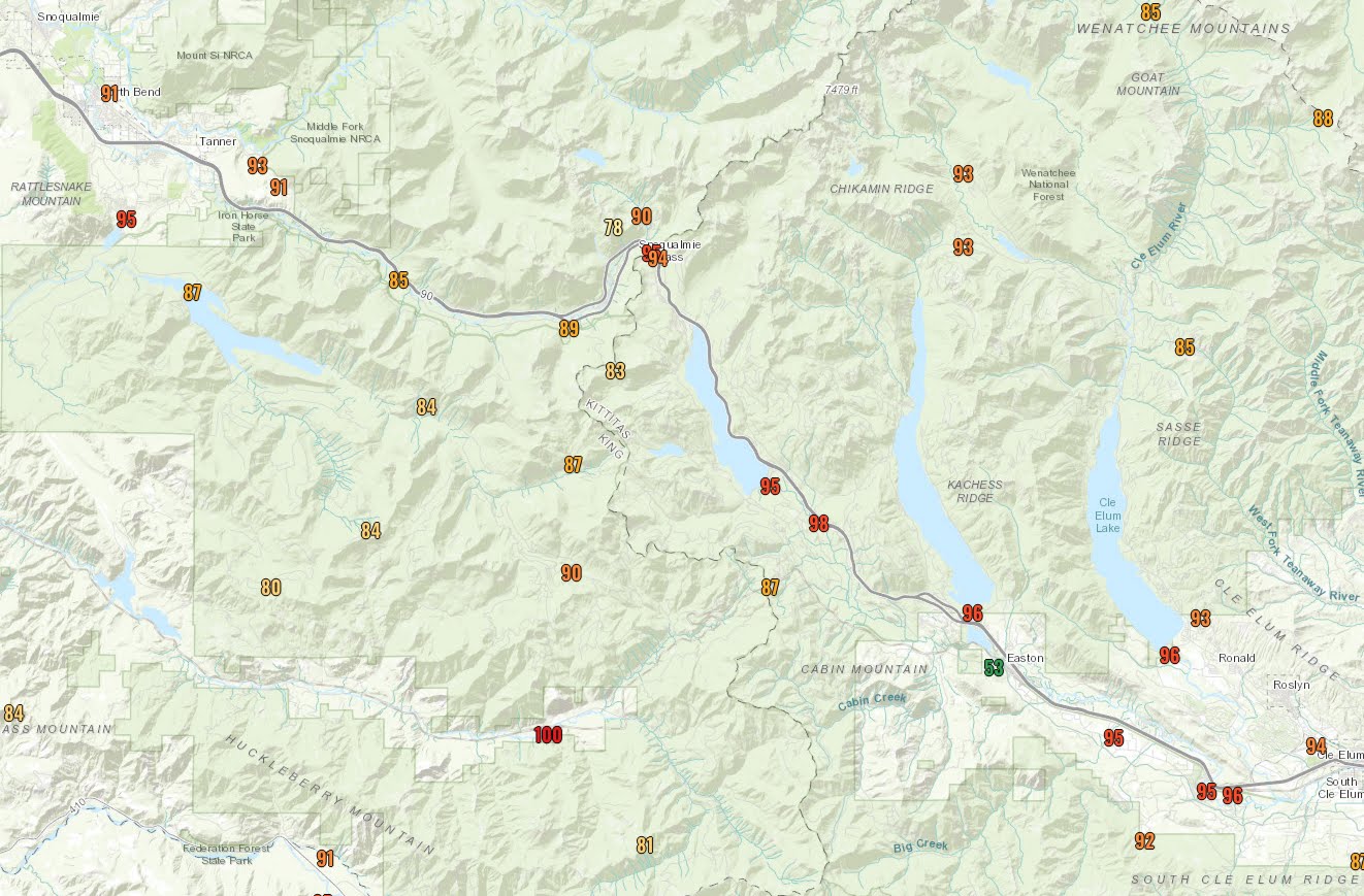
Talking about temperatures, yesterday was a very warm day, getting into the lower 90s from Puget Sound southward and into the 100s in eastern WA. But perhaps the most unusual aspect were the temperatures in the mountains, where some pass locations got into the upper 80sF and higher (see below, click to expand). Stampede Pass at 4000 ft maxed out at 88F and mid-90s reached the eastern slopes of the Cascades. We had very warm air aloft, that approximately tied long-term record values.
Today will be smoky and warm away from the coast, but tomorrow we will start transitioning to cooler, onshore flow. Relief is only 24 hour away.
Posted by Cliff Mass at 7:27 AM
cliffmass.blogspot.com |


