The East Coast’s town most vulnerable to coastal flooding takes a direct hit
(excerpt)
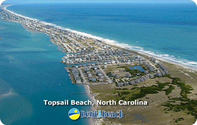
What may be the most vulnerable town to coastal flooding on the U.S. East Coast, North Topsail Beach, North Carolina, took a direct hit from the worst of Hurricane Florence’s storm surge on Friday. In their excellent 2016 book, Retreat From a Rising Sea: Hard Choices in an Age of Climate Change (see my review here), Duke University sea level rise expert Dr. Orrin Pilkey and co-authors ranked North Topsail Beach as the second-most dangerous island for development in the United States, behind only Dauphin Island, Alabama. North Topsail Beach, an 11.1-mile long community on the northern third of Topsail Island, is low and narrow (25 yards wide in some locations), and has a single escape road that easily floods and will prevent escape even in the earliest phase of an approaching hurricane. The single row of dunes on the island was bulldozed up from the beach, and disappears quickly in storms. Hurricane Fran (1996), a Category 3 storm with 115 mph winds that made landfall near Cape Fear, North Carolina, brought a storm surge estimated at 6 – 7 feet above ground, which cut at least six inlets across the island.
 | | Figure 5. Houses are seen near high tide on September 11, 2018 in on North Topsail Beach, North Carolina, two days before the arrival of Hurricane Florence. Image credit: Logan Cyrus /AFP/Getty Images. |
“The irresponsibility of development on this hazardous island is breathtaking,” the authors wrote. “A number of high-rise condominiums and hotels have been built, including the high-end St. Regis Resort and Villa Capriano condo/hotels.” A 2009 technical report co-written by Dr. Pilkey and geologist William Neal, North Topsail Beach, North Carolina: A model for maximizing coastal hazard vulnerability, has more detail on why they rate this location as being so dangerous. In fact, development on the islands is so ill-advised that residents there cannot get flood insurance from the National Flood Insurance Program, or beach replenishment and some forms of disaster aid from the Federal Government. This is because of a designation under a 1982 law Congress passed called the Coastal Barrier Resource Act (CRBA), intended to discourage development on risky and environmentally sensitive areas of the coast. The development that has occurred on North Topsail Beach was criticized in a 2015 op-ed by Dr. Robert S. Young, professor of coastal geology at Western Carolina University, who called the town one of the most poorly managed beach communities in the U.S.
wunderground.com
what could possibly go wrong?
 |


