asher-resources.com
Corporation Capital Structure | Symbol | ACN - TSX.V | | Current Share Price (May 2013) | $0.20 per share | | Shares issued | 14.9 million shares | | Public float | 9.8 million shares | | Options/warrants | 4.8 million shares | | Fully diluted | 19.7 million shares | | 52 Week High/Low | CND $0.34 - $0.10
|
|
35 tons at 2 oz's per ton 10 feet below surface
ftp://nas.library.unr.edu/keck/mining/SCANS/2640/26400001.pdf
asher-resources.com
from way back when good reading on king mine page 3
ftp://nas.library.unr.edu/keck/mining/SCANS/2640/26400004.pdf
ACN The mineralized Zone 350 feet wide by 3/4's of a mile is highly mineralized altered Rhyolite
ftp://nas.library.unr.edu/keck/mining/SCANS/2640/26400004.pdf
Paul R. Mattinen, BSc Geo Engineer, C.P. Geo.Chief Geologist, USA
Mr. Mattinen (based in Nevada) has 35 years of precious and base metals exploration experience in North America. His expertise is in epithermal and orogenic gold, volcanogenic massive sulfide, porphyry gold
The King Mine from MD&A
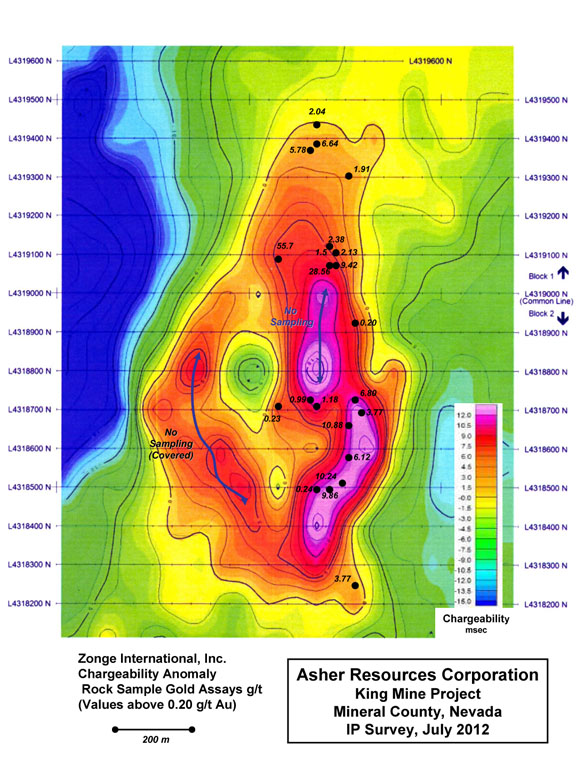
The King Mine drilling program is designed to test a 1200 m long IP chargeability anomaly with significant gold values and a coincident elliptical to arcuate magnetic feature suggesting a mineralized copper-gold porphyry system at depth. The interpreted intrusive is presumed to be a porphyry style driver for the surface hydrothermal alteration overprinted with gold values and, in itself, could host a major copper-gold deposit. Drilling will be initially focused on assessing silicified gold bearing zones in the chargeability anomaly for near surface resources amenable to open pit mining. The magnetic anomaly, a low, indicates alteration and magnetite destruction in both the host volcanic rocks and the postulated intrusion. Preliminary data from field mapping has identified a cluster of small dacite to rhyolite dikes and irregular plugs coincident with the magnetic low. These features represent either co-mineral or post mineral intrusions a feature common to mineralized copper – gold porphyry systems.
asher-resources.com
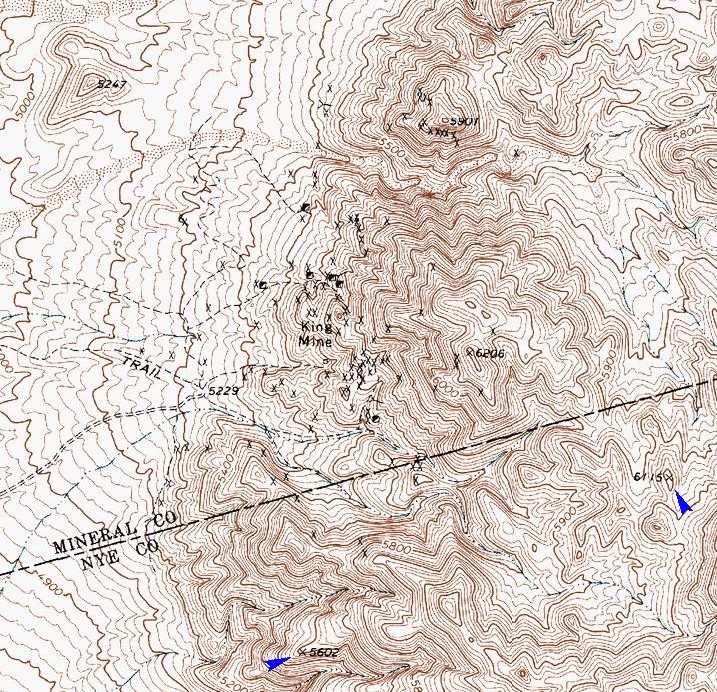
all the X's are prospect locations (shafts). ..
See above king to the right. Lots there to.
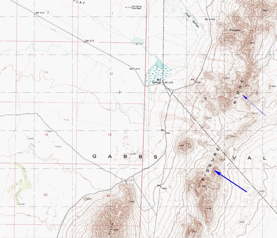
yes. you were right. I can see the hot springs / cold springs on this map and the fissure ridge..
All the old timer data on King Property from 1920 to 1963
ftp://nas.library.unr.edu/keck/mining/SCANS/2640/26400004.pdf
ftp://nas.library.unr.edu/keck/mining/SCANS/2640/26400003.pdf
ftp://nas.library.unr.edu/keck/mining/SCANS/2640/26400002.pdf
ftp://nas.library.unr.edu/keck/mining/SCANS/2640/26400001.pdf

look at the bubble ring around king mine
gold prices in 1926 and 1927 was 20.64 per oz
silver prices in 1926 and 1927 were 54 cents and 57 cents per oz (checked and seen some silver prices at .35 cents per oz in this time to so not sure which is right)
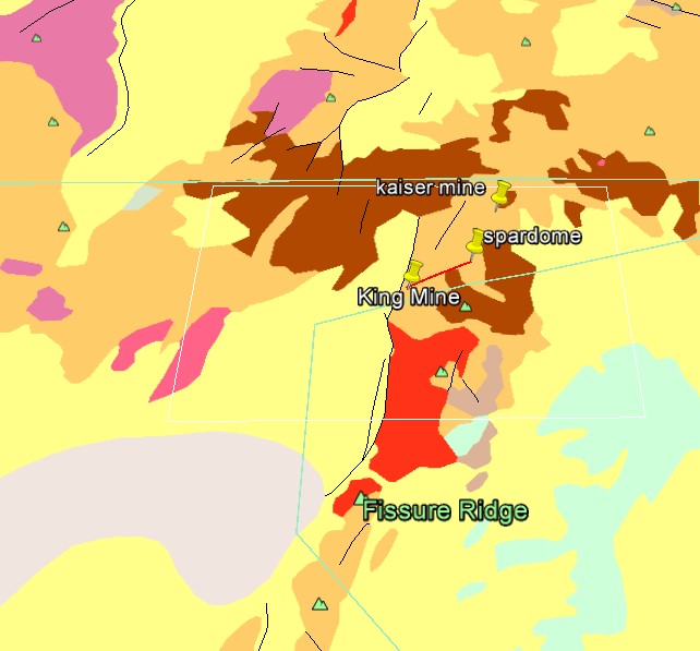
you can zoom in on king here and see its rock types.
mrdata.usgs.gov awesome stuff at king mine and surrounding area
Red block is Plutonic and Intrusive 70 mil to 100 mil years old
Multiple Events happened at King if you check around on the map you will see other mines around
the Red Plutonic Intrusives
nbmg.unr.edu
 |


